Figure 5-1 provides the policy map for the Conestoga River and illustrates how the river will be reimagined in the coming years. The City’s efforts are part of a broader effort to incorporate the river in Lancaster County’s green infrastructure network, including improved points of access, points of extension, and points of development.
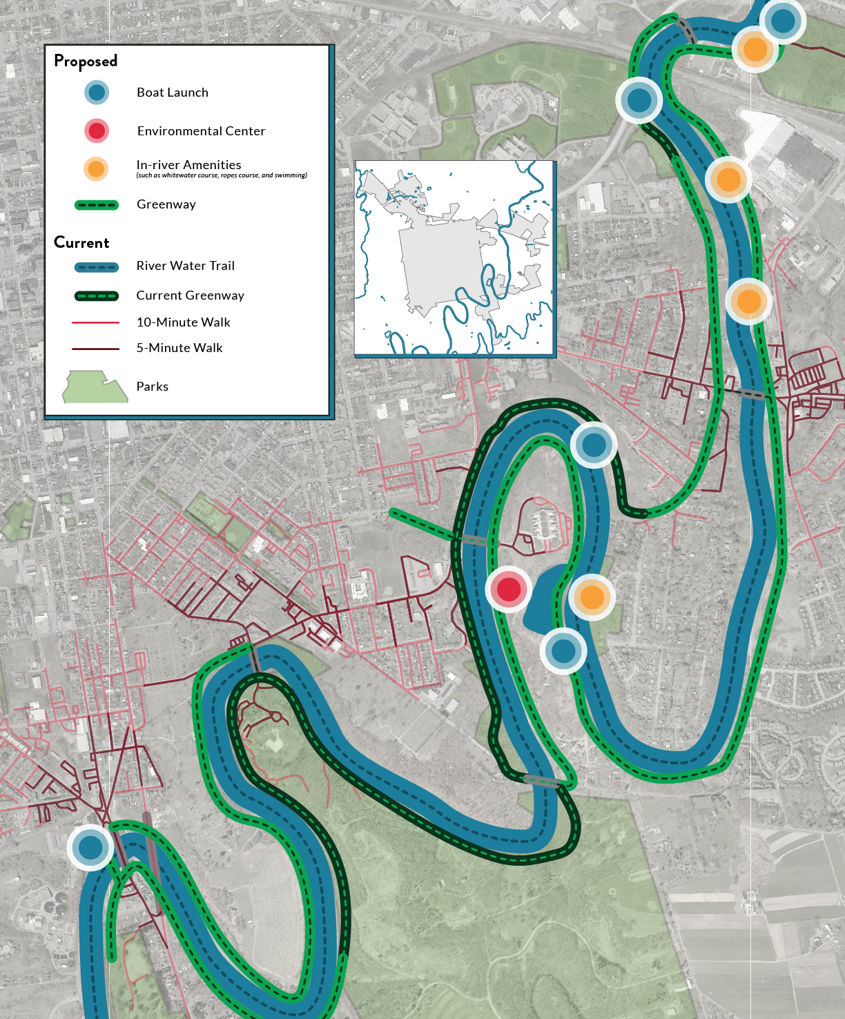
Figure 5-1: Conestoga Riverfront Policy Map
Points of access include the locations where the community can physically connect to the river. Few of the historic access points still exist and most that do are not readily accessible or are in poor condition. Creating non-motorized access points such as trailheads and parking, will help propel the overall riverfront strategy. Access improvements include a water trail in the river, along with extension of the Conestoga River Greenway to better serve nearby neighborhoods. This will be paired with opportunities for river access in future shoreline development, and on City-owned parcels such as those on the Sunnyside Peninsula.
Points of extension include ways to better integrate the river into community life, including education, conservation, recreation, and economic development. This includes school curricula on the river and water quality. It also includes protection of natural resources and environmental restoration. The City will also integrate the river into the park system and include the river in neighborhood economic development strategies.
Points of development are the geographic locations where future community development activities can incorporate the river as a focal point and amenity. These include Engleside, Bridgeport, and Sunnyside, as well as other smaller connection points near the shoreline. Land use planning and infrastructure improvements in these locations should anticipate ways for residents and visitors to better engage with the river.